A Place for Everyone.

The Recreation
A GRAND JOURNEY OF DISCOVERY
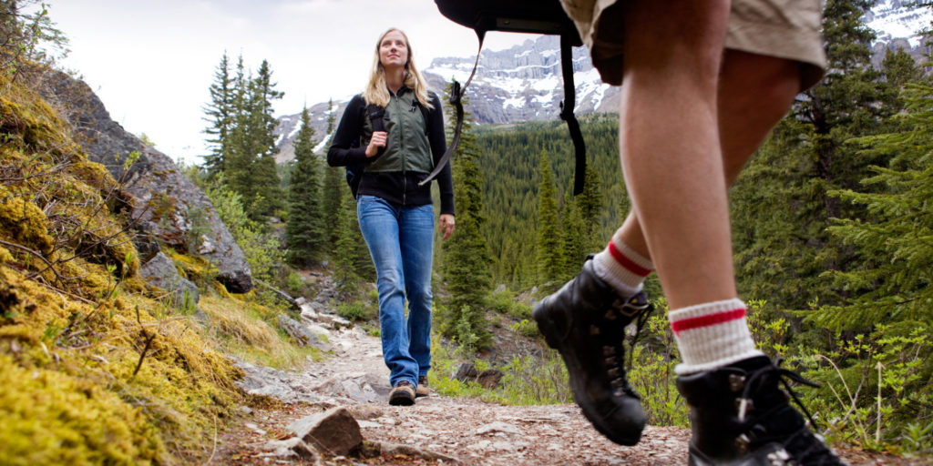
Recreation includes hundreds of miles of trails for hiking and horseback riding, fishing on the Bitterroot River or in mountain, boating and hunting. Bicycling is popular thanks to a new trail paralleling Highway 93 between Lolo and Hamilton. Downhill and cross country skiing at Lost Trail Pass is some of the best in Montana! Lake Como, south of Hamilton, is a popular destination for residents and vacationers as are the many U.S. Forest Service campgrounds throughout the area. There are thousands of acres ready to be explored.
The Bitterroot Valley is surrounded on the west by the spectacular Bitterroot Mountains featuring multiple canyons with streams that join the Bitterroot River. Every canyon has a trail to the west that enters either the Selway Bitterroot or the Frank W. Church wilderness areas. These two areas combine to total 3,714,471 acres. The highest peak in the Bitterroot Range is Trapper Peak at 10,157 feet. The Sapphire Range to the east side of the Valley also has protected areas with the highest peak in this range being Kent Peak with an elevation of 8,999 feet. The Painthorse Ranch offers fabulous mountain views of both the Bitterroot Range and the Sapphire Mountains.
Bitterroot Valley equestrians enjoy easy access to the mountains, rodeos, and training events throughout western Montana. There is a County Rodeo in Hamilton and a larger event in Missoula every year. Darby has a Bull Riding competition and senior events that bring high quality riders for large purses annually. The Saddle Tramps offers new comers a chance to meet other trail riders every week to explore various trails throughout the Valley. This all gal club has been in the Valley for over 30 years. Back Country Horseman plan overnight and weekly events throughout the region. If you love horses, the Bitterroot Valley is your kind of place.
Popular pastimes in and around the Bitterroot include:
- HUNTING & FISHING
- HORSEBACK RIDING
- GOLFING
- BIRD, WILDLIFE AND NATURE PHOTOGRAPHY
- CROSS COUNTRY & DOWNHILL SKIING, SNOWBOARDING & SNOWSHOEING
- HIKING, CAMPING, MOUNTAINEERING & ROCK CLIMBING
- SWIMMING, BOATING, WATER SKIING, KAYAKING AND RAFTING
- RESORT AND NATURAL HOTSPRINGS
- GLACIER AND YELLOWSTONE NATIONAL PARKS, LEWIS & CLARK CAVERNS
- GOLD PROSPECTING, SAPPHIRE & CRYSTAL DIGGING, GEM & MINERAL HUNTING
- ATV & SNOWMOBILING
- MOUNTAIN AVIATION
- ENTERTAINING, COOKOUTS & GAMES
- PET EXCURSIONS, WALKING & BIKING
- LAKESIDE & SCENIC AREA PICNICS
- DINING, PUBS & BREWERIES, DANCING, THEATER AND CONCERTS
- EXPLORING HISTORIC SITES, GHOST TOWNS, BUILDINGS, OLD MINING CAMPS
- MUSEUMS AND GALLERIES
- CAR & AVIATION SHOWS,
- SHOOTING SPORTS AND WORKSHOPS
- CHURCH EVENTS, CIVIC GROUPS, SEWING AND QUILTING CLUBS
- COUNTY FAIRS, ANNUAL COMMUNITY EVENTS, STRAWBERRY, APPLE AND BLUEGRASS FESTIVALS, MUSIC CONCERTS
- ARTS, CRAFTS & MUSIC WORKSHOPS
- WORLD CLASS DARBY RODEO AND LOGGER DAYS
River Access is just Minutes Away.
The Bitterroot River
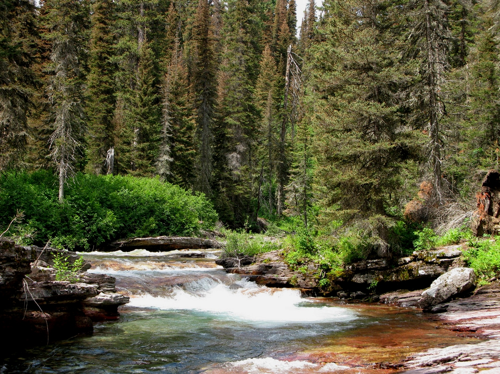
The crystal-clear water of the Bitterroot River flows like life’s blood through the high mountain valley that shares its name. A peaceful retreat, the river is home to abundant fish, waterfowl and wildlife. Easily accessed and navigated, every spot along it's winding path offers breathtaking views of Montana's scenic beauty.
The river finds its beginnings in two small mountain canyons – the East Fork and the West Fork. Both forks offer good wading and casting challenges with lots of boulder, natural structures and pools. South of the small western community of Darby, the two forks merge together and become the main river. The river is one of only 5 in the nation which flows north and offers recreation and wildlife habitat for over 50 miles before flowing into the Clark Fork.
Unlike many waters in the Pacific Northwest, the Bitterroot River is fishable year around. The general trout season runs from mid-May into the fall, but the river is also open to fishing in the winter and spring for whitefish and catch-and-release on trout. Fish are primarily rainbows and cutthroat with an average size of 12 to 14 inches. Recent regulations are making it more ordinary to catch trout over 16 inches to 20 inches. Some brook trout are also present. Deep holes hold large brown trout. Access is very easy with developed parking areas along the river corridor for float fisherman and wade casting.
River flows are strong on the Bitterroot River with snow pack melt from Painted Rocks Reservoir being released into the river to maintain instream flows in warmer weather. This was a huge accomplishment of local sportsman, The Bitterroot Chapter of Trout Unlimited , Department of Natural Resources, and Montana Fish Wildlife and Parks.
Top dry fly patterns include mayflies, caddis, stoneflies, humpies, salmon flies, drakes, and many of the popular attractor patterns. The local fly shops offer local specialties such as Purple Haze and others.
The beauty of the Bitterroot River will remain in the memory long after the fishing is done. Winding through narrow canyons past Indian petroglyphs under the watchful eye of towering Trapper Peak and Como Peaks, the river offers an escape from human noise and the tasks for life. Whitetail deer, beaver, otters, moose, ducks and geese, and more surprises await the ones who ventures there.

Nearby Mountain Lakes and Creeks![]()
A short distance from Hamilton, are many high mountain lakes with hiking trails. Check out Camas Lake, Canyon Lake, and Fuse Lakes for trout fishing and grayling. Small streams and creeks are also within a very short distance from local towns. Skalkaho Creek, Tin Cup Creek, Blodgett Creek, Mill Creek, and others all offer casting opportunities for small trout and day hiking - some with waterfalls. If one were to begin today and fish all the waters available in the Bitterroot Valley, it would take a lifetime!

JAN KING, BROKER
Phone: 406-369-4313
Email: jan.king@ranchmt.com
DISCOVER MONTANA'S BITTERROOT VALLEY
Enable sound and view full screen.

